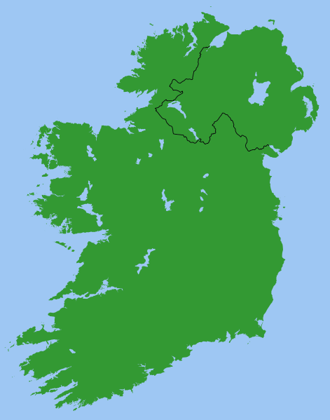
ファイル:Ireland.svg

提供: ナショナルチーム
ナビゲーションに移動 検索に移動

元のファイル(SVG ファイル、2,200 × 2,800 ピクセル、ファイルサイズ: 204キロバイト)

このファイルは共有リポジトリから来ており、他のプロジェクトで使用されている可能性があります。 共有リポジトリでのファイル解説ページにある説明を以下に示します。

概要

Map of Ireland, with North-South boundary delimited.
SVG should be fairly easy to alter or expand. For example the following can all be achieved with one-line CSS changes:

  • You can toggle the Northern Ireland border on/off or change its thickness
  • You can change any of the colours
  • You can draw a border around all the land to make it more distinct from the sea
  • You can hide Northern Ireland or the Republic of Ireland.

You can also do any of the following just by changing or adding/removing a few lines of SVG code:

  • Zoom in on Northern Ireland, the Munster shoreline, or any other area
  • Remove all the small islands (e.g. for faster rendering)
  • Add drop shadows (feGaussianBlur), textured ground (feTurbulance) or topography (feDisplacementMap + feSpecularLighting)
  • Add cities and towns.
  • Add rivers. Anyone care to do this?

Originally derived from Image:Lough-Neagh.svg.

ライセンス

Public domain この作品の著作権者である私は、この作品についての権利を放棄しパブリックドメインとします。これは全世界で適用されます。
一部の国では、これが法的に可能ではない場合があります。その場合は、次のように宣言します。
私は、あらゆる人に対して、法により必要とされている条件を除き、如何なる条件も課すことなく、あらゆる目的のためにこの著作物を使用する権利を与えます。

s]]

キャプション

このファイルの内容を1行で記述してください
Ireland

ファイルの履歴

過去の版のファイルを表示するには、その版の日時をクリックしてください。

日付と時刻サムネイル寸法利用者コメント
現在の版2007年3月14日 (水) 06:492007年3月14日 (水) 06:49時点における版のサムネイル2,200 × 2,800 (204キロバイト)increased default size, modified lough Erne

以下の 1 ファイルが、このファイルと重複しています (詳細):

このファイルを使用しているページはありません。